

parseta.pl
Aktualności
28 maj 2026 Łosoś wraca do gry. Wielka koalicja samorządu, wód polskich, nauki i NGO na rzecz dzikiej Parsęty

Łosoś wraca do gry.Czytaj dalej
28 maj 2026 Kolejny EkoPiknik z okazji Światowego Dnia Migracji Ryb za nami!

W minioną sobotą z okazji Światowego Dnia Migracji Ryb zorganizowaliśmy kolejny EkoPiknik, tym razem w Barwicach. Wydarzenie edukacyjno-ekologiczne cieszyło się ogromnym zainteresowaniem, nie tylko ze strony dzieci i młodzieży. Podczas pikniku można było porozmawiać ze strażnikami rybackimi jak chronić nasze wody i przeciwdziałać kłusownictwu, z ichtiologiem o ekosystemie wodnym oraz wziąć udział w grach i zabawach o tematyce ekologicznej W trakcie pikniku świętowaliśmy także #FunduszowyMaj Czytaj dalej
02 kwiecień 2026 Pułapka rotacyjna do połowu smoltów na Parsęcie uruchomiona!
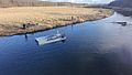
Informujemy, że na rzece Parsęcie w rejonie miejscowości Ząbrowo została uruchomiona pułapka rotacyjna do połowu smoltów łososia i troci wędrownej. Połowy prowadzone są przez Instytut Rybactwa Śródlądowego w Olsztynie we współpracy z ZMiGDP.Pułapka rotacyjna jest przydatnym narzędziem do monitorowania tego specyficznego cyklu życia ryb łososiowatych, jakim jest smoltyfikacja i spływ smoltów do morza. Uzyskane w ten sposób dane służą do oceny czasu migracji smoltów oraz określenia ich liczebnościCzytaj dalej
13 styczeń 2026 Raport z licznika przepływających ryb za 2025 r.
Informacja o wynikach monitoringu migracji ryb przepławką na zaporze elektrowni „Rościno” w 2025 rokuCzytaj dalej
18 grudzień 2025 Rozpoczęcie projektu LIFE FOR RIVERS

Z radością ogłaszamy rozpoczęcie projektu LIFE FOR RIVERS (L4R)! Za nami pierwsze spotkanie i wizja terenowa z udziałem partnerów. Celem projektu jest m.in.: przywrócenie ciągłości ekologicznej Parsęty i jej dopływów,poprawa warunków rozrodu ryb (troci wędrownej, lipienia, głowacza białopłetwego) oraz minogów (rzecznego i strumieniowego),odtworzenie populacji łososia atlantyckiego w Parsęcie m.in. poprzez zarybianie, poprawę jakości siedlisk oraz ich ochronę,odbudowa siedlisk podmokłych i lasóCzytaj dalej